
Genera videos de mapas animados y visualizaciones de datos a partir de prompts de texto o descripciones JSON para su uso en videos explicativos y documentales.
También conocido como 21prnv/mapcast
- Stars
- 6
- Herramientas
- —
- Descargas, 30 días
- —
- Última versión
- 0.1.1
- Último commit
- 2 nov 2026
- Licencia
- MIT
¿Qué es mapcast MCP?
Genera videos de mapas animados y visualizaciones de datos a partir de prompts de texto o descripciones JSON para su uso en videos explicativos y documentales.
Resumen generado a partir del README del proyecto
Acerca del MCP server de mapcast
Crear videos de mapas animados para documentales o shorts de redes sociales es posible con esta herramienta mediante el uso de prompts de texto o descripciones JSON. Permite a los usuarios resaltar países, estados o provincias específicos usando varios estilos como tintes sólidos, contornos o incluso colocando una bandera nacional sobre el terreno. El servidor admite diversos basemaps, incluyendo NASA Blue Marble, imágenes satelitales Sentinel-2 y estilos de pergamino antiguo.
Diseñado específicamente para agentes de IA, el servidor se puede integrar en clientes MCP como Claude Desktop, Cursor o Windsurf. Proporciona dos herramientas principales: render_map para generar videos o imágenes completos y preview_map para revisar un solo frame antes de un renderizado completo. Los usuarios deben tener ffmpeg instalado en su sistema local, y la configuración inicial descargará Chromium y los datos de mapas necesarios. El sistema puede producir múltiples formatos, incluyendo MP4, GIF, PNG y JPG en varias relaciones de aspecto como 16:9 o 9:16.
Qué puedes hacer con él
- 1Generar shorts de mapas para redes socialesCrea un video vertical que haga girar el globo terráqueo y se detenga en un país específico con su bandera.
- 2Visualizar distribuciones de datos geográficosProduce un mapa que coloree diferentes países basándose en valores numéricos específicos como el desempleo o el PIB.
- 3Crear mapas de estilo históricoRenderiza un mapa de pergamino antiguo con ciudades específicas marcadas para contenido educativo.
Escrito a partir del README del proyecto. Cada caso de uso se verifica con una cita del mismo.
Cómo instalar mapcast MCP
Formatos verificados el 10 nov 2026Añadir a CursorAñadir a GooseInstalar mapcast MCP en Claude Code
$ claude mcp add mapcast -- npx -y mapcastInstalar mapcast MCP en Cursor
~/.cursor/mcp.json
{
  "mcpServers": {
    "mapcast": {
      "command": "npx",
      "args": [
        "-y",
        "mapcast"
      ]
    }
  }
}Instalar mapcast MCP en VS Code
.vscode/mcp.json
{
  "servers": {
    "mapcast": {
      "type": "stdio",
      "command": "npx",
      "args": [
        "-y",
        "mapcast"
      ]
    }
  }
}Instalar mapcast MCP en VS Code CLI
$ code --add-mcp '{"name":"mapcast","type":"stdio","command":"npx","args":["-y","mapcast"]}'Instalar mapcast MCP en Claude Desktop
claude_desktop_config.json
{
  "mcpServers": {
    "mapcast": {
      "command": "npx",
      "args": [
        "-y",
        "mapcast"
      ]
    }
  }
}Instalar mapcast MCP en Codex
$ codex mcp add mapcast -- npx -y mapcastInstalar mapcast MCP en Codex config.toml
~/.codex/config.toml
[mcp_servers.mapcast]
command = "npx"
args = ["-y", "mapcast"]
Instalar mapcast MCP en Gemini CLI
$ gemini mcp add -s user mapcast npx -- -y mapcastInstalar mapcast MCP en Gemini settings.json
~/.gemini/settings.json
{
  "mcpServers": {
    "mapcast": {
      "command": "npx",
      "args": [
        "-y",
        "mapcast"
      ]
    }
  }
}Verificaciones automáticas
Ejecutado 14 nov 2026Informe completo →Pasó nuestras verificaciones automáticas. Esto no es una auditoría de seguridad: lee el código y dale al servidor el acceso más limitado que necesite. Cómo funcionan las verificaciones

- Repositorio de origen vinculado y accesible21prnv/mapcast is public and reachablegithub.com/21prnv/mapcast ↗Aprobado
- El paquete indica este repositorio como su origenmapcast names 21prnv/mapcast as sourcenpmjs.com/package/mapcast ↗Aprobado
- Procedencia de la compilación (atestación de Sigstore)Sigstore attestation for mapcastnpmjs.com/package/mapcast/v/0.1.1#provenance ↗Aprobado
- Licencia de código abierto (OSI)MITspdx.org/licenses/MIT.html ↗Aprobado
- Commit o lanzamiento en el último añoLast commit or release 2026-11-02github.com/21prnv/mapcast ↗Aprobado
- OpenSSF ScorecardNo verificado
- El nombre del paquete no es similar a un paquete popularNo popular package one edit away from mapcastAprobado
- No hay avisos críticos en el paquete ni en sus dependencias103 resolved dependencies checked; no critical advisoryosv.dev ↗Aprobado
- Sin instrucciones ocultas para el modelo0 tool descriptions and the README read; no override phrases, credential paths or hidden charactersAprobado
- Las herramientas destructivas están etiquetadasNo verificado
- El endpoint remoto responde al handshake de MCPNo verificado
README
Ver en GitHubmapcast
Animated map videos for explainers, documentaries and Shorts, from one line of JSON. Highlight any country, state or province on real satellite imagery or an old paper map: tracing borders, flags, glow, labels, capitals, data colours, a 3D globe dive and camera flights between countries. Free, open source, and built for AI agents to drive.


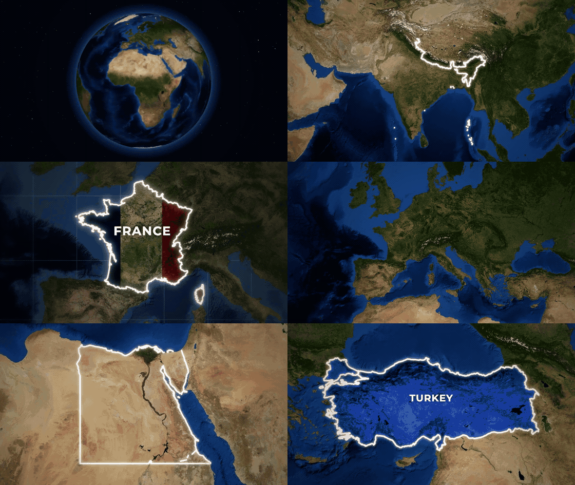
Full-quality version: docs/showcase.mp4
npx mapcast quick India -o india.mp4
That is the whole setup. The first run downloads Chromium and map data once (both cached); videos also need ffmpeg.
Ask your AI for it
mapcast is made to be driven by AI tools: you describe the map, the agent writes the scene, mapcast renders it.
"Make a YouTube Short that spins the globe and lands on Brazil with its flag." "Old parchment map of Turkey, zooming in, with Istanbul marked." "Colour these countries by unemployment: Spain 11.4, Greece 9.8, Germany 3.4."
Claude Code (skill and MCP server in one install):
/plugin marketplace add 21prnv/mapcast
/plugin install mapcast@mapcast
Claude Desktop, Cursor, Windsurf, Codex or any MCP client: add this to the client's MCP config.
{
  "mcpServers": {
    "mapcast": { "command": "npx", "args": ["-y", "mapcast", "mcp"] }
  }
}
The server offers render_map (saves the video or image and returns a preview of the final frame, so the agent
can check its work) and preview_map (one frame, to check a scene before rendering). Every option is described
in the tool schema.
Agents that read SKILL.md skills: npx skills add 21prnv/mapcast. The skill is in
skills/mapcast, with 27 worked request-to-scene examples.
What it can do
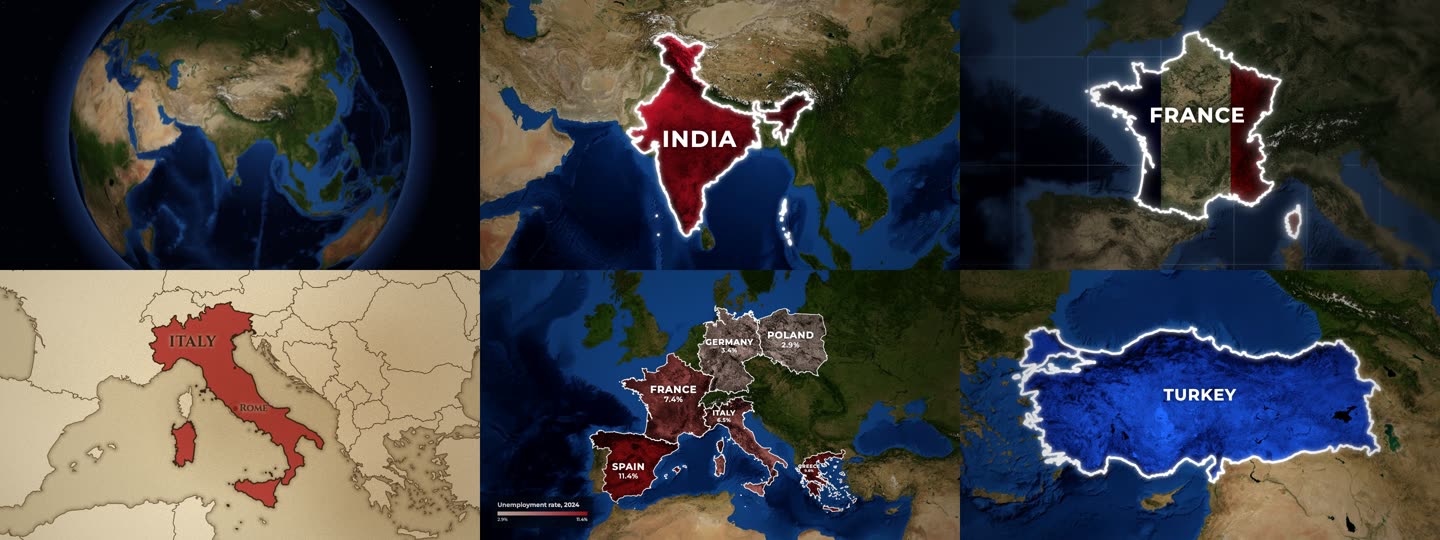
- Styles: colour tint that keeps the terrain visible, spotlight (rest of the world turns grey), outline, or the country's flag laid over its land.
- Basemaps: NASA Blue Marble and Sentinel-2 satellite imagery, or an old parchment map with engraved coasts.
- Cameras: slow push-in, zoom in from a wide view, dive from a spinning 3D globe, fly from country to country.
- Places: every country by name or ISO code, plus 4,500 states and provinces (
"California","IN-MH"), with capitals or any city marked. - Data maps: colour countries by a number with a legend, with names and values on the map.
- Formats: MP4, GIF, PNG, JPG in 16:9, 9:16, 1:1 or 4:5.
- Disputed borders: drawn the way the highlighted country officially draws them, or a neutral view on request.
Command line
npx mapcast quick "United States" --style highlight --color yellow -o usa.png
npx mapcast quick France --style flag -o france.mp4
npx mapcast quick Brazil --camera globe -o brazil.mp4          # dive in from a spinning Earth
npx mapcast quick India France Japan --camera fly -o tour.mp4   # fly from country to country
npx mapcast quick Italy --basemap paper -o italy.mp4

npx mapcast render scene.json -o out.mp4        # any scene; .mp4, .gif, .png or .jpg
npx mapcast render scene.json -o out.png --at 1.2
cat scene.json | npx mapcast render - -o out.gif
npx mapcast schema                              # the scene format as JSON Schema
npx mapcast mcp                                 # MCP server on stdio
Every file in examples/ renders as-is.
Scene format
{
  "aspect": "16:9",
  "duration": 5,
  "camera": "push-in",
  "highlights": [
    { "country": "India", "style": "solid", "color": "#c8102e", "label": "INDIA" }
  ]
}
| Field | Values | Default |
|---|---|---|
aspect |
16:9, 9:16, 1:1, 4:5 (or set width/height) |
16:9 |
duration |
seconds | 5 (7 for globe, 1 + 3 per country for fly) |
fps |
frames per second | 30 |
camera |
push-in, zoom-in, globe (3D Earth dive), fly (country to country), static, or { "move", "fill", "from" } |
push-in |
basemap |
satellite, bluemarble, sentinel, paper (old parchment map) |
satellite |
pov |
auto (the country's own official borders), default, or a code like ind, chn, pak |
auto |
effects.grade |
natural, muted, mono |
natural |
effects.vignette |
0 to 1 | 0.45 |
effects.blur |
0 to 1: soft-focus edges, like a camera lens | 0 |
effects.grid |
true or { "step", "color", "opacity" }: lat/long grid over the sea only |
off |
effects.borders |
true: thin borders of neighbouring countries |
on for paper and states |
labelAnim |
default label animation for every highlight | rise |
Each highlight:
| Field | Values | Default |
|---|---|---|
country |
name ("India") or ISO code ("IN", "IND") |
country or region required |
region |
a state or province: "California", "Bavaria", "US-CA", "IN-MH" |
|
style |
solid (tinted fill), highlight (rest of the world goes grey), outline, flag (the country's flag over the terrain) |
solid |
color |
any CSS colour or red, yellow, blue, ... |
a distinct colour per country |
label |
text, or false for none |
the country name |
border |
{ "color", "width", "glow" } or false |
white, glowing |
labelAnim |
rise, type (typewriter), spread (letters close in), slide, pop |
rise |
labelSize |
multiplier on the automatic label size, e.g. 0.7 or 1.3 |
1 |
labelFont |
sans, serif, or any font name |
sans (serif on paper) |
capital |
true for the capital (a state's own capital for region), or a city name like "Mumbai" |
off |
start |
seconds when this country starts animating | staggered automatically |
Data maps
Colour countries by a number, with a legend:
{
  "data": {
    "title": "GDP 2024 (trillion US$)",
    "prefix": "$",
    "unit": "T",
    "scheme": "heat",
    "values": { "India": 3.9, "China": 18.7, "Japan": 4.1 }
  }
}
scheme is one of reds, blues, greens, heat, purples, diverging, or a list of colours.
Set "labels" to "name", "value" (the number with prefix/unit) or "both" to label each country,
and min/max to fix the colour range. A highlight's label can have a second line: "INDIA\n1.4 BILLION".
How it works
A scene is resolved against Natural Earth borders, the imagery tiles the camera path needs are fetched and cached, and a headless Chromium draws each frame on a canvas (WebGL for the globe). Frames are piped to ffmpeg. A 5 second 1080p clip takes about 15 seconds on a laptop.
Credits and licence
MIT. Map data, imagery and font licences are in NOTICE.md. Satellite imagery needs a credit line wherever you publish; mapcast prints the exact line after every render.
Contributions are welcome: see CONTRIBUTING.md.
Preguntas sobre mapcast MCP
¿Cómo agrego mapcast MCP a Claude Code?
Ejecuta claude mcp add mapcast -- npx -y mapcast en tu terminal. Añade --scope user para que esté disponible en todos los proyectos.
¿Cómo agrego mapcast MCP a Cursor?
Abre ~/.cursor/mcp.json y añade el servidor en mcpServers, usando la configuración de Cursor que se muestra en la sección de instalación de arriba.
¿Cómo puedo usar mapcast con un agente de IA?
Puedes añadirlo a clientes MCP como Claude Desktop, Cursor o Windsurf agregando el servidor a tu configuración de MCP.
¿Qué estilos de mapas hay disponibles?
Los estilos disponibles incluyen tintes de color, spotlights que oscurecen el resto del mundo, contornos y la superposición de la bandera de un país sobre su territorio.
¿Puedo crear mapas basados en datos?
Sí, puedes colorear países mediante valores numéricos usando varios esquemas de color e incluir una leyenda con títulos y unidades.
¿Qué formatos de archivo admite?
La herramienta admite la renderización de videos e imágenes en formatos MP4, GIF, PNG y JPG.